US Patrol in India’s EEZ
Context
Recently, India protested against the US decision to conduct a patrol in the Indian Exclusive Economic Zone (EEZ) in the western Indian Ocean, rejecting the US’ claim that India’s domestic maritime law was in violation of international law.
More about news
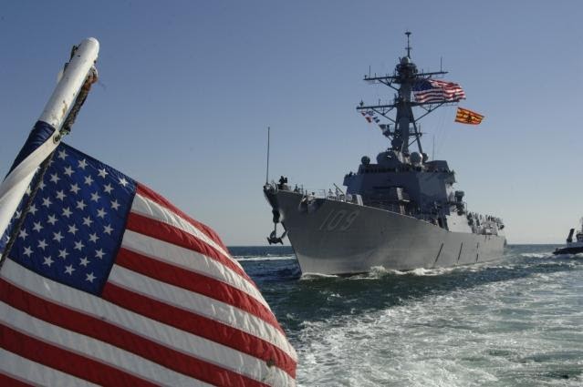
The US Seventh Fleet announced that one of its warships, USS John Paul Jones (DDG 53), had carried out a Freedom of Navigation Operation (FONOP) west of Lakshadweep Islands, inside India’s EEZ, without requesting India’s prior consent, consistent with international law.
FREEDOM OF NAVIGATION OPERATION (“FONOP”)
the Freedom of Navigation Operations involves passages conducted by the US Navy through waters claimed by coastal nations as their exclusive territory.
the FON Program has existed for 40 years, and continuously reaffirmed the United States’ policy of exercising and asserting its navigation and overflight rights and freedoms around the world.
US Department of Defense (DoD) says these “assertions communicate that the United States does not acquiesce to the excessive maritime claims of other nations, and thus prevents those claims from becoming accepted in international law”.
India’s Protest
India’s stated position on the United Nations Convention on the Law of the Sea (UNCLOS) is that the Convention does not authorise other States to carry out in the EEZ and on the continental shelf, military exercises or manoeuvres, in particular those involving the use of weapons or explosives, without the consent of the coastal state.
t is only when it is “military manoeuvres” in Indian EEZ that nations need to seek India’s permission and not if they are simply transiting through.
Seventh Fleet to carry out FON missions in Indian EEZ in violation of Indian domestic law (Territorial Waters, Continental Shelf, Exclusive Economic Zone and Other Maritime Zones Act, 1976).
BACK TO BASICS
UNITED NATIONS CONVENTION ON THE LAW OF THE SEA
The United Nations Convention on the Law of the Sea (UNCLOS) is an international agreement that resulted from the third United Nations Conference on the Law of the Sea (UNCLOS III), which took place between 1973 and 1982.
The Law of the Sea Convention defines the rights and responsibilities of nations with respect to their use of the world’s oceans, establishing guidelines for businesses, the environment, and the management of marine natural resources
The convention set the limit of various areas, measured from a carefully defined baseline.
The areas are as follows:
o Internal waters – Covers all water and waterways on the landward side of the baseline. The coastal state is free to set laws, regulate use, and use any resource. Foreign vessels have no right of passage within internal waters. A vessel in the high seas assumes jurisdiction under the internal laws of its flag State.
o Territorial waters – Out to 12 nautical miles (22 kilometres; 14 miles) from the baseline, the coastal state is free to set laws, regulate use, and use any resource.
o Vessels were given the right of innocent passage through any territorial waters, with strategic straits allowing the passage of military craft as transit passage, in that naval vessels are allowed to maintain postures that would be illegal in territorial waters.
o Contiguous zone – Beyond the 12-nautical-mile (22 km) limit, there is a further 12 nautical miles (22 km) from the territorial sea baseline limit, the contiguous zone. Here a state can continue to enforce laws in four specific areas (customs, taxation, immigration, and pollution) if the infringement started or is about to occur within the state’s territory or territorial waters. This makes the contiguous zone a hot pursuit area.
o Exclusive economic zones (EEZs) – These extend 200 nmi (370 km; 230 mi) from the baseline. Within this area, the coastal nation has sole exploitation rights over all natural resources. In casual use, the term may include the territorial sea and even the continental shelf. The EEZs were introduced to halt the increasingly heated clashes over fishing rights, although oil was also becoming important.
o Continental shelf – The continental shelf is defined as the natural prolongation of the land territory to the continental margin’s outer edge, or 200 nautical miles (370 km) from the coastal state’s baseline, whichever is greater.