SVAMITVA SCHEME
CONTEXT
Recently, the Ministry of Panchayati Raj has released the new framework for implementation of the SVAMITVA Scheme.
MORE ABOUT SVAMITVA SCHEME
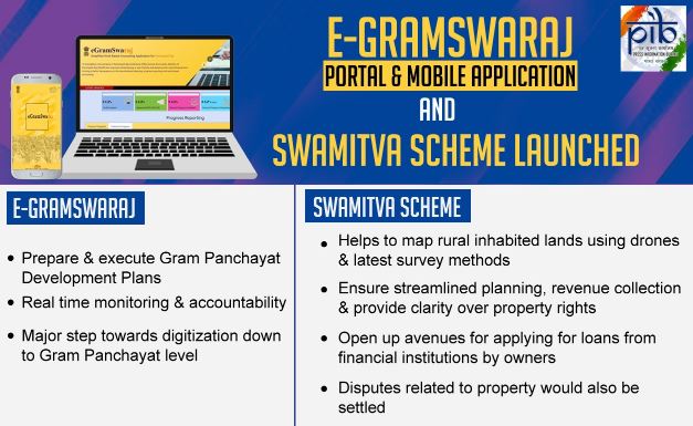
SVAMITVA stands for Survey of Villages and Mapping with Improvised Technology in Village Areas.
It aims to provide rural people with the right to document their residential properties so that they can use their property for economic purposes.
The scheme is for surveying the land parcels in rural inhabited area using Drone technology. The survey shall be done across the country in a phase wise manner over the period 2020 – 2025
OBJECTIVES
To bring financial stability to the citizens in rural India by enabling them to use their property as a financial asset for taking loans and other financial benefits.
Creation of accurate land records for rural planning.
Determination of property tax, which would accrue to the GPs directly in States where it is devolved or else, add to the State exchequer.
Creation of survey infrastructure and GIS maps that can be leveraged by any department for their use.
To support in preparation of better-quality Gram Panchayat Development Plan (GPDP) by making use of GIS maps.
To reduce property related disputes and legal cases
EXPECTED OUTCOME
The outcome from the scheme would include updating the ‘record-of-rights’ in the revenue/property registers and issuance of property cards to the property owners.
This would facilitate monetization of rural residential assets for credit and other financial services. Further, this would also pave the way for clear determination of property tax, which would accrue to the GPs leading to better civic amenities.